mNo edit summary |
No edit summary |
||
| Line 13: | Line 13: | ||
In [[2293]], the location of Sirius in the [[Milky Way Galaxy]] was labeled in a [[star chart]] that was in [[Captain]] [[James T. Kirk]]'s [[quarters]] aboard the {{USS|Enterprise|NCC-1701-A|-A}}. ({{film|6}}, ''[[okudagram]]'') |
In [[2293]], the location of Sirius in the [[Milky Way Galaxy]] was labeled in a [[star chart]] that was in [[Captain]] [[James T. Kirk]]'s [[quarters]] aboard the {{USS|Enterprise|NCC-1701-A|-A}}. ({{film|6}}, ''[[okudagram]]'') |
||
| − | In [[2364]], the location of Sirius |
+ | In [[2364]], the location of Sirius was labeled in a star chart of a stellar neighborhood with Sol at the center. This chart was stored in the {{USS|Enterprise|NCC-1701-D|-D}} [[USS Enterprise (NCC-1701-D) library computer|library computer]]. Later that year, the chart was scanned by the [[Portal]] of [[Portal 63]]. ({{TNG|The Naked Now}}, ''production art''; {{TNG|The Last Outpost}}) |
== Background information== |
== Background information== |
||
Revision as of 22:10, 21 July 2014
The location of Sirius on The Explored Galaxy star chart
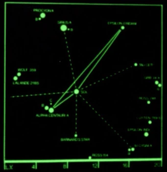
The location of Sirius on a star chart
Sirius was a binary star system consisting of the stars Sirius A and Sirius B. This inhabited system was located approximately eight light years from the Sol system. (TNG: "The Naked Now" production art)
The Sirius Cybernetics Corporation originated in this system. (TNG: "Conspiracy", "The Schizoid Man", display graphic/set decoration; Star Trek: Deep Space Nine set decorations)
In the mid-to-late 21st century, the Treaty of Sirius was signed, ending the Kzin War between Earth and the Kzinti. (TAS: "The Slaver Weapon")
In 2267, Sirius was one of the stars Lieutenant Sulu used to calculate the Enterprise's position after it had been displaced 500 parsecs by the Metrons. (TOS: "Arena")
In the mid-23rd century, Harcourt Fenton Mudd paid a visit to the inhabitants of Sirius IX. (TAS: "Mudd's Passion")
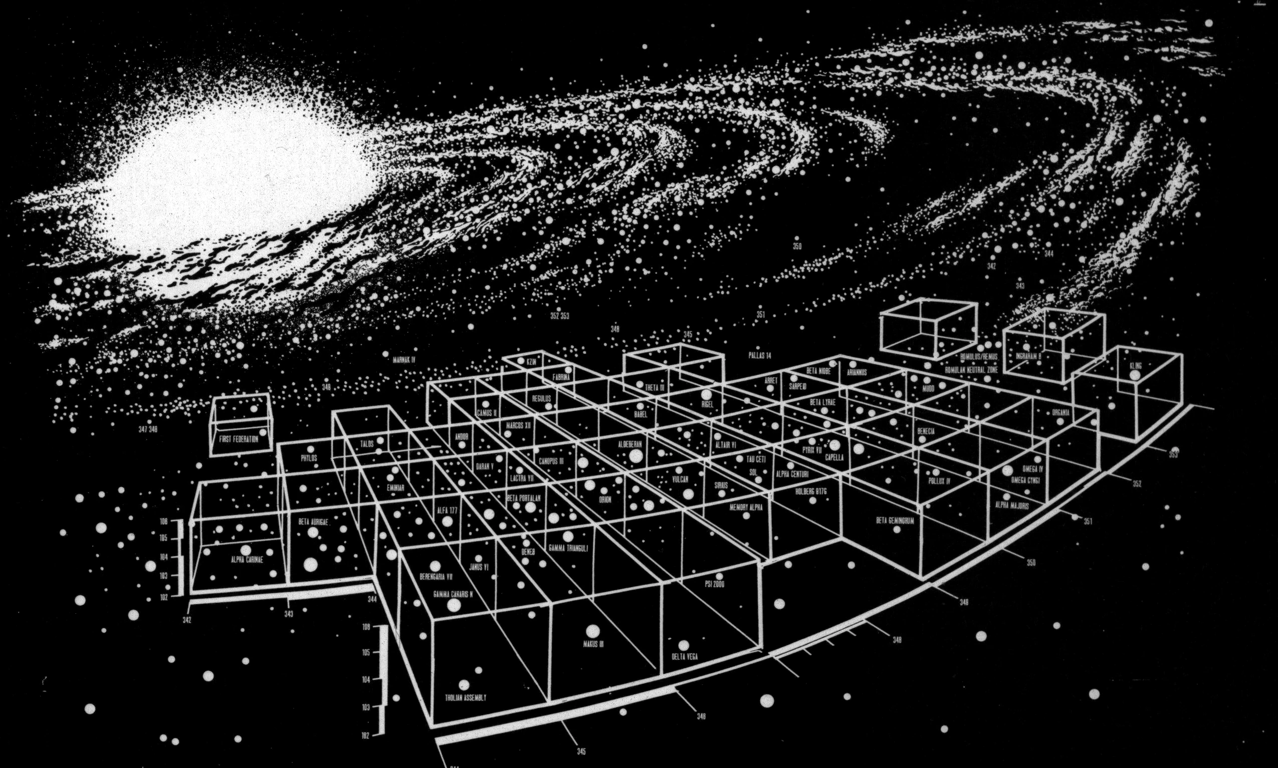
In 2293, the location of Sirius in the Milky Way Galaxy was labeled in a star chart that was in Captain James T. Kirk's quarters aboard the USS Enterprise-A. (Star Trek VI: The Undiscovered Country, okudagram)
In 2364, the location of Sirius was labeled in a star chart of a stellar neighborhood with Sol at the center. This chart was stored in the USS Enterprise-D library computer. Later that year, the chart was scanned by the Portal of Portal 63. (TNG: "The Naked Now", production art; TNG: "The Last Outpost")
Background information
The Sirius group was mentioned in Gene Roddenberry's original Star Trek pitch in one of the suggested story lines. In the storyline "Kentucky, Kentucky," the Sirius group was home to an Earth colony for fifty years. This colony was attacked by viking-like savages and reduced to a "frontier" log-fort life. They were regrouped and led by Captain Robert April when the SS Yorktown visited the colony.
The chart naming stars within 20 light years of Sol was originally drawn by Rick Sternbach for the Star Trek Spaceflight Chronology in the late 1970s. Found on page 77, this chart showed Earth commercial and exploration routes after the use of warp drive began. Sirius was a destination on an exploration route.
According to Star Trek: Star Charts (pg. 45), Sirius, also known as Alpha Canaris Majoris, was located in or near Federation space, in the Beta Quadrant. It was a binary star system. Sirius A was an A-class star with a magnitude was +1, which was a hundred times brighter than Sol. Sirius B was also an A-class star.
External links
- Template:NCwiki
- Sirius at Wikipedia
- Sirius at the Internet Stellar Database